We started our trip
to Arkansas on a Friday Morning. Me, my wife, and my good friend
Walt. For this trip I was driving my 1996 Z71, (known to most
readers of ORC as Project Z-71), and Walt was driving his
modified 1996 Jeep Cherokee. Being as that we were comming from
Dallas/Fort Worth, Texas, we expected the drive to take about 4
hours. Wolf Pen Gap is near Mena, Arkansas. We left around 7:00am.
At 1:00pm, we still were not there! We discovered along the way
that most of the roads in Arkansas that aren't an interstat highway
are only 45mph roads!! It wound up taking us about 5 1/2 hours to
get there.
Now, before I go any further, let me tell you about my phone call
to the National Forest Service. I called and asked them a few weeks
before the trip what the best JEEP and OFF-ROAD Vehicle trails were
in the Ouchita National Forest. They told me Wolf Pen Gap. I then
said, "Isn't that a bunch of ATV (4Wheeler) trails?" She said,
"Yes, but Jeeps, and Trucks do them all the time. I've taken my
Forest Service Truck down them. Its a full-size Chevy." So after
hearing that, I was ready to go. I figured my 35" tires would make
this one easy!
 
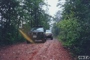
Well, we were there, at
the trail head, it was raining and were soaked. There was a big
sign that said "4x4's and ATV's only past this point." So we locked
in the four-wheel-drive, and headed down the trail. It was great
for about the first mile, then well.... have you ever tried puting
a camel through the eye of a needle? Try driving a full-size
extended cab z71 with a 6" lift and 35" tires down an ATV trail.
I've got news for you though... IT CAN BE DONE! Now, Walt, with his
Cherokee with 3" lift and 32" tires had no problem. He made it all
look easy. Unfortunately, I can not show you how bad it was,
because the pictures of the area did not turn out (What ever
happened to my Kodak moment!!)!
The trails consisted of over 40
miles of winding trails. Most only about 4 1/2 feet wide. These
trails run through the mountains too, so on one side you sometimes
have 100 ft straight down, while on the other side its 100 ft
stright up! After doing about 1/3 of the trails, we decided my Z-71
was just way too big to do the rest, even though Walt's Jeep was a
perfect fit... Besides the rain was driving us nuts!
 
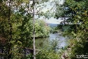
That night we camped at
a place called Shadey Lake. It was 32 miles away from Wolf Pen
Gap's trail head, and it was in the middle of nowhere. The closest
town was Athen's with a population of 82 people! Click on the
pictures to the right and you'll see just how awesome it was.
Interestingly enough, with the rain, we found getting to our camp
site more difficult than the trails we had jsut driven. It was 32
miles of dirt (MUDDY) roads.
I started out in two-wheel-drive until
we started our ascent up the first mountain, and my rear decided to
go one way, while the cab went the other. I radioed Walt on the CB
and advised him to lock them in. He said back to me "I'm doing
fine." Then about 5 seconds later I hear "Wooah! Locking them in!" It was actually quite an exciting drive!
The campsite had two creatures that kept bugging us. Especially at
night, so if you camp there, enjoy. They are: Coons, and Skunks!
The skunk just wanted our dinner. We gave it to him! Who am I to
argue with a stinky little guy like that anyway? Actually, he had
gotten into our left overs. The coons bothered us at night.
Continually getting in the bed of my truck. Where I had coolers,
water bottles, gas cans, etc. One nice thing about Shady Lake, is
that you can fish there without a liscence, so bring your
poles!

On our way out, we ran into the Forest Ranger
and asked him about any other trails in the area. His exact words
were "If you see a dirt road, and it doesn't say KEEP OUT, then its
free game. Just don't carve any new ones." So on the way out we
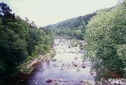
took a route that led us to the little stream. The water was cold,
but it was crystal clear. Probably from natural springs.
To get to
the Wolf Pen Gap area, (Jeeps recommended...) drive your favorite
route to Mena, AR. From Mena, take Hwy 8 east to State Road 375.
Take 375 South about 8 miles to the trail head. You will find maps,
and emergency numbers there. Make sure you take them with you.
Enjoy your trip!
Due to volume of email, we cannot respond to every
letter we receive. |


 Your Privacy Choices