This report can be used as a supplement to Leonard
Lauria's trip report on S Tree, Kentucky which also described several
trails near the S Tree Campground.
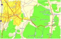 For
this excursion into S Tree, I started at the Daniel Boone Tavern on East State
Route 21 in Berea, Kentucky. The route can be accessed from one of two exits
along Interstate 75.
Traveling east on Route 21 from the tavern for two miles, one will pass the
Berea Ranger Station at the city limits. There you can acquire two essential
U.S. Geological Survey maps which are modified for forestry service use. When
combined, the Sandgap and Parrot Quadrangle maps will cover most of the
Millcreek Wildlife Area as well as the warren of roads and trails that run
through it. A second map, the Daniel Boone Forest Central map, issued by the
Forestry Service, fails to diagram many of the more primitive trails but does
lay out the small towns and state routes that surround the park.
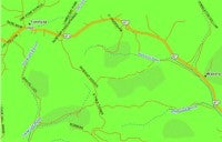 From
the ranger station, it is 2.8 miles to the junction with Route 421. At the
intersection, follow Route 421 south for 10 miles to the town of Sandgap. The
town has several gas stations and a market for last minute refueling or
supplies.
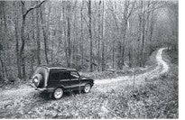 Continuing
through to the town limits, S Tree Road will branch to the right. Follow this
road for 1 mile before taking the left fork at the gravel intersection. From
this point, the next 8 miles will consist of well maintained gravel roads. In
February, when the park is closed for the season, most of the side roads will be
closed with a gate or posted as private. At the gravel intersection, turn left
and continue for 4 miles. A sign will direct you into the campgrounds.
Passing through the campgrounds, you will arrive at a gravel intersection
southeast of the last camp site. Here, Trail 302 branches south into the Renfro
Valley Drainage Area while Road 3098 parallels the trail southeast along the
ridge.
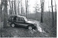 Before
making my choice, I surveyed Trail 302 on foot and very quickly determined it
too narrow for the Land Rover Discovery that I was driving (or for any four
wheeled drive vehicle with a paint job). More importantly, the cold front that
had passed through earlier in the day left several inches of standing water
which obscured much of the trail. Further down the trail, as it began to descend
toward the Renfro Creek, the mud had mixed with red clay to make the trail
indistinguishable from the ridge. Several miles down the ridge, the trail
terminates at Road 431 which, when taken northward, will return to the
campground.
Back in the driver's seat, my only option was Road 3098.
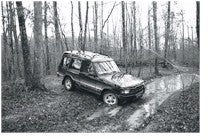 After
a slight, unremarkable rise, the road levels off into an immediate mud pit.
Coming so quickly after leveling off, I found the Discovery submerged over the
wheels in mud and sinking fast. My first reaction was to panic and stop the
vehicle, which I did. With mud girgling into the cab, I managed to pull out
using drive three and the differential and put the behemoth on some leaves
beside the trail. Most of the upper portion of 3098 was a series of deep mud
holes and overgrown brush. Later, I was comforted by one of the Rangers who
informed me that the forestry service lost one of their utility vehicles on that
portion of the trail.
At a quarter mile, the trail, which is also referred to as Ridge Road,
descends along the eastern side of the Renfro Ridge with the Panther Creek to
the east of the road. Into the descent, the road noticeably narrows and erodes,
exposing slippery rock that can be navigated with minimal skill. Halfway into
the descent, the road becomes very steep so I locked my differential into low
and, using drive one, coasted down most of the ridge with minimal use of the
brake. The foliage along the road has not been maintained so your vehicle will
take some solid hits.
I measured the descent to be around 3 miles. Road 3098 terminates at Highway
89 at the base of the ridge.