Brought to you by Off-Road.com ©
WELCOME TO THE McGREW TRAIL, OREGON'S FIRST ADOPT-A-TRAIL!
VOLUNTEER STEWARDSHIP IS SHARED BY THE CAVEMAN FOUR WHEELERS OF
GRANTS PASS AND THE FOUR RUNNERS OF KLAMATH FALLS, OREGON.

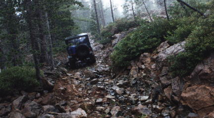
The following will help to acquaint the first-timers on this trip with the trail and it's significant history. While this trip may not be the roughest you have ever been on, it is rough enough to slow you down for a few hours and allow you to enjoy some beautiful country
#############
The trail was discovered by two sailors fiom the shipwrecked schooner "Paragon" in 1852 who ventured inland to the Illinois Valley and brought word of a quiet bay and an Indian trail that could be cleared to a new port. To the miners in Jacksonville, Oregon, and the northerly Illinois Valley, this was welcome news. The miners had discovered much gold but transportation to a safe place had been a problem.
The first trail to Paragon Bay was a wicked test of man's endurance. It wound from the beach through Elk Valley and across the ridge to ford Smith River. It followed the north fork and climbed in a series of traverses to the top of Cold Spring Mountain. For 20 miles, the hastily chopped out trail was 2,000 feet above the heavily wooded valleys and streams on either side ofthe mountain. That first year the drivers had to camp at night in the shelter of a cave or under the branches of a wind-driven tree. It was dangerous, steep, hazardous and often slick with ice and at times waist deep in snow.
In the fall of 1853, J.C. Walker established Robin's Nest at the Oregon-California border, or where the border line came to be. At Robin's Nest there was a corral for mules, dinner and a bed in the bunkhouse for drivers. The prices were as high as was the altitude, and the place was soon known the length of the trail as "Robber's Roost". Freight prices were wicked. W. W. Fowler screamed like a panther when he was charged 50 cents a pound to have a pool table brought to Jacksonville for his saloon.
By 1854 the trail was crowded and the drivers were forced to line up the mules and post riders ahead and behind with their shrill bells clanging to warn others oftheir approach.,
Often strings of pack animals met face to face as they rounded the sharp curves and the brawls of the drivers could be heard echoing in the valley.
The town of Paragon Bay was soon named Crescent City. It had a population of over 1,000 farmers, miners and business men. In June 1857, the Crescent City Plank, Road and Turnpike Company agreed to build a wagon and stage road for $50,000,. Ofthis sum, $10,000 was recruited from Happy Camp, Yreka and Jacksonville. The road was finished in April 1858 and on May 19 the first stage arrived in Crescent City from Jacksonville. It was a toll road and cost $10 for a six-horse team. Most ofthe freight was transported in large two-deck wagons drawn by a six-mule team. This road was situated north of the old trail and stage stops were quickly established at Altaville and Rockland to take care of the passengers and animals. On the valley floor, the main street of Sailor's Diggings (changed to Waldo in 1856) was the beginning of the road west to Crescent City. In Jacksonville, James Cluggage and John Drum, with 321 horses in their stables, advertised a tri-weekly stage to the beach city. Smaller than the famous Concorde, these stages were constructed of canvas over wood, with bright yellow wheels, running gear and tongue. The sides were painted a gallant red, and they carried 10 passengers in a steady trot (about 6 MPH) along the Applegate River, past Fort Hayes, Kerbyville to Sailor's Diggings and the new Pioneer Road. No longer was the mule asked to do the nearly impossible such as transporting a grand piano, which actually happened. Now such heavy and bulky shipments could be made by wagon.
The stages and wagons kept fairly accurate schedules from April until the rainy season. When heavy weather closed the road, the mules were hitched up again and the express riders, who carried most ofthe gold and important papers, kept the mail moving. This portion of the road was utilized until 1870. By this time the McGrew Trail was in poor repair and other routes along easier terrain were discovered and developed, thus closing a segment of historical travel on the McGrew Trail.
#################
It is difficult to imagine traversing this trail on harsh iron bound wood wheels as we ride in comparative comfort on radial tires!
Hope this small bit of history gives everyone some insight into the hardships endured by the pioneers who opened this country and who left behind this trail that we now enjoy.......
How to get there:
The maps you need are - Oregon Topographic Maps: Obrien, Buckskin Peak, Buscuit Hill- These are in the south west corner of the state. The trail head is off Wimer road around 5 miles west of US Hwy 199 at Obrien Oregon. The trail head is posted with a club sign on the right side of the road. GOOD camping at Sourdough on the North Fork Smith River! (In Oregon)Return to Off-Road.com Home page
Copyright © Off-Road.com, 1996 All Rights Reserved


 Your Privacy Choices