 |
Growing up as a Navy lad, I spent a lot of time moving from station to station as my mother and I followed my father. Therefore, since my mother was somewhat directionally challenged at the time, I was forced to learn how to read a map at an early age. I also learned to love those very same maps—to me half the fun of the trip was in the planning (and it still is). What made it much easier on both of us in those days was that the guys in the service stations actually knew more about whatever area we found ourselves in than we did. Unfortunately, paper maps could be going the way of the dodo bird—free maps are already as extinct as the dinosaurs that became our fuel.
No one could have foreseen what would happen when that first Sputnik was tossed into space in 1957, except perhaps Arthur C. Clarke—considered the father of the communications satellite. Now, we have more than 20 sophisticated satellites in geosynchronous orbits all around the Earth dedicated to just GPS. One of the other things nobody could have foreseen in those days is that we now have maybe 20 fuel-station attendants nationwide who know enough about the areas in which they work to give competent directions. Besides, Jeepers want off-road coverage as well as on-road charts; hence, the need for a GPS unit.
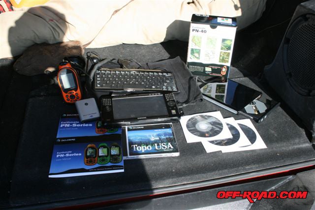 |
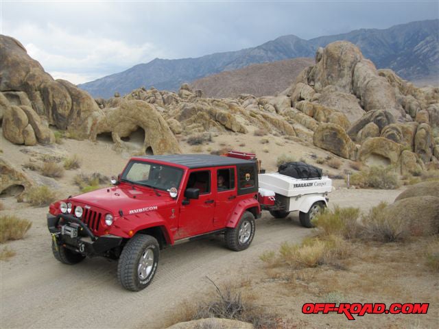
| This is just about everything you’ll need for using Topo USA 8.0 in either a laptop (the UMPC) or the PN-40. Since I was testing the systems in my Jeep, I used the rear deck of my JK for the display. |
More and more new Jeeps are being delivered with onboard, in-dash GPS navigation systems—either factory- or dealer-installed options. They’re cool options, but they’re also expensive and they can’t be used in more than one vehicle or on a hike. I like versatile vehicles; i.e., Jeeps, dual-sport motorcycles, etc., so if I’m going to spend some coin, I want something that’s as versatile as I can get. Hence, something like a laptop computer, GPS software, or a hand-held PN-40 from DeLorme.
Now, as we all know, you are able to use cell phones for directions, but outside large metropolitan areas—such as the Southwestern deserts—cell coverage ain’t so great, and who wants to wear reading glasses while driving to see those tiny screens? So, if you happen to be directionally challenged, if you want topographic maps (topo maps give the land contours as well as man-made features), if you want to find that hidden ghost town, and if you wish to map your route for other people to follow on future trips (or on return visits), let us see what two new topographic GPS alternatives can give you.
For this article I tested one GPS software package—DeLorme’s Topo USA 8 (version 8 of the very popular mapping software from DeLorme Mapmakers of Yarmouth, Maine, on four DVDs)—residing on two devices; a Samsung Q1 Ultra Premium UMPC (ultra mobile personal computer) and DeLorme’s Earthmate PN-40 water-resistant hand-held unit.
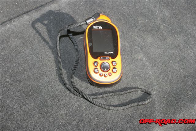 |
| The Earthmate PN-40 is too sophisticated and complicated to go into all its functions in this limited space. You’ll have to read and become familiar with its owner’s manual to fully avail yourself of all its features. |
I used the UMPC rather than a full-sized laptop for two main reasons. The primary reason is that it operates on 12 volts DC, which not too many laptops can use (most of them require 120 volts AC). I also wanted a smaller unit because a full-sized laptop just gets in the way in a 2007 Jeep Wrangler Unlimited. Also new with DeLorme’s Earthmate GPS LT-40 satellite antenna is the NavMode option, which is a “cockpit view” showing improved use of navigation information and user controls. “The LT-40 is a very practical GPS solution for anyone with a laptop PC,” said Caleb Mason, director of marketing at DeLorme. “It offers advanced GPS capabilities at a very low cost—just $69.95 with Street Atlas USA 2009.” Author’s note: Street Atlas USA 2009 Plus and the LT-40 bundle is $99.95 and the Street Atlas USA 2009, LT-40, and Topo USA 8.0 bundle is $149.95.
System requirements: Microsoft Windows Vista Home Basic/Home Premium/Ultimate/Business with 512 MB RAM (1 GB recommended), Microsoft Windows XP (Service Pack 1 and later) with 128 MB RAM (256 MB recommended), Microsoft Windows 2000 (Service Pack 3 and higher) with 64 MB RAM (256 MB recommended). For a Macintosh, it is compatible with Intel-based Macintosh computers running Boot Camp for Windows XP. Hardware requirements: Intel Pentium 900 MHz or higher processor (1.8 GHz recommended), since the software is on a single DVD-ROM the PC must have DVD capability, 700MB of available hard-disk space is required (1.8GB if all map data is loaded to hard drive), and a 3D-capable video card with 32MB VRAM (64MB VRAM recommended).
Topo USA 8.0
Used in both pieces of hardware for this test, Topo USA 8.0 is said to be the most comprehensive computer mapping program for outdoor recreation, with excellent maps, trip planning features, on-/off-road navigation, and GPS capabilities. This edition of Topo USA is by far the best value for the price of any of the previous Topo USA editions. It includes complete USA topographic maps, detailed streets, and USA trails; detailed streets for Canada; major roads for Mexico; over four million places-of-interest (POIs); and the ability to share your custom maps. The included comprehensive Topo USA maps have updated terrain and hydro data, the latest roads, trails, BLM, national park, national forest, and other publicly-managed lands, and game management districts.
 |
Two captured screws secure the back cover of the PN-40 and rubber gaskets keep its insides dry and functional in any weather and under almost any conditions. |
A Topo USA file stores the map center and zoom level along with links to route, waypoint, track, and other draw files that have been added to the file or project. Project files are valuable—they let you organize related files like the annual club runs’ tracks and waypoints and return to them later for review and planning. To create a new project, you use the options available in Topo USA’s Map Files tab. Once you create a new project, you can add existing data to the file by clicking the Map File tab’s Add option and selecting either Draw or Route.
The map files you create can be controlled using a variety of methods, including the traditional push-button zooming, which cycles in/out while keeping the map exactly centered. Also, holding down the left mouse button enables you to drag and zoom, left-to-right, across the map; moving the mouse in the same manner but in the opposite direction zooms out.
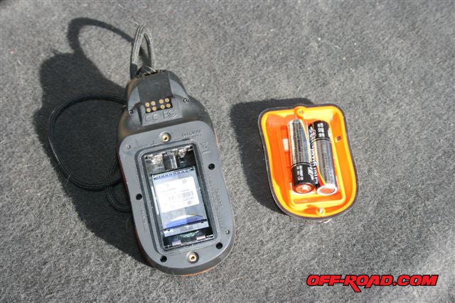 |
| The included 1-GB SD card sits in a slot under the two AA batteries (batteries are resting on the back cover). Note the black rubber gasket framing the back cover. The PN-40 card slot supports up to 32-gigabyte SD cards. |
You can see the terrain in vivid detail using the 3-D map views and controls. These realistic views also retain the various elements you add to your customized maps. The split-screen framework lets you see 2-D and 3-D maps side by side, with linked Draw tools that move and update in tandem. Now you can also grab the 3-D map views using the image grabber tool and scroll rapidly through 3-D views with great precision. The 3-D software engine has been completely rebuilt for this new version.
The Profile tool lets you click on a route, line object, or body of water and see the elevation gain between one point and the next. This is ideal for Jeepers, hikers, and ATV riders wanting to know the elevation on their trips. You can also add MapNotes; draw your own circles, polygons, and squares; measure the area of your draw objects—even draw in your own trails and route on them. The Measure Tool lets you measure linear distance and area on the map based on the units chosen in the Display tab of the Options dialog box. Draw polygons on the map and see the square footage or acreage of plots of land. Just right-click on the map to learn more about what’s underneath your cursor; names of streets and trails (bodies of water) can be viewed in this manner. Moreover, the bottom toolbar of the software displays a continuously updated readout of what’s underneath your cursor. In addition, you can add your own images, diagrams and documents to the maps. Embed photos and diagrams showing club members what they will find at each location, and save a record of exactly where you took your digital photos (all you need is a GPS track). The enlargeable thumbnail images appear on your map exactly where you took them on your trip.
Create automatic road routes to get you to the trailhead and then use the automatic trail routing to bring on your club runs. You can create routes from the Route tab or by simply right-clicking on the map and setting your Starts, Stops, and Finish points. New Topo USA 8 is the ability to create and save commonly-used names for places you visit often, such as “home,” work,” or “Dad’s.” Once these names are assigned, the routing Starts, Stops, and Finishes also display these names, making retrieval easy for repeated usage. Customize routes using your own names and save them within MapShare for others to see and use (you can also include up to 200 names from your address book to be recognized using this system).
PN-40
If you like to climb out of your Jeep once in awhile to hike, ride a dirt bike or ATV, or spend some time in a bass boat, the DeLorme Earthmate PN-40 GPS waterproof handheld unit may be ideal for you. The PN-40 comes equipped with a three-axis electronic compass that can provide compass direction even while stationary. With 360° rotation roads, buildings, and other images really are on your left or right as you look at the map and hike or drive. Its three-axis electronic compass with an included accelerometer performs when held in any position—while in motion or standing still. Its electronic compass is disabled when moving and the GPS heading is used; however, the PN-40 makes it easy to calibrate the compass for use in the field by simply following the on-screen directions and you’re set to go.
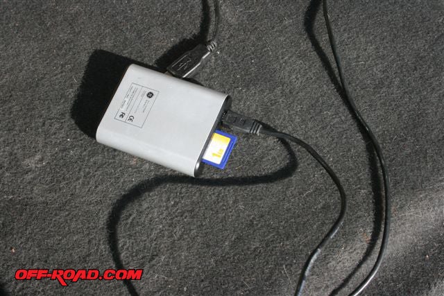 |
| I used a GE multi-card reader for data transfer. Card readers are available at most office supply stores. |
The PN-40 also comes equipped with a barometric altimeter for providing accurate altitude readings, which works in conjunction with the GPS to measure elevation when using auto calibration. And since it’s lightweight (without batteries: 5.35 ounces; with alkaline AA batteries: 7.00 ounces) this makes it easy to carry along on a hike in its supplied belt holster.
Here there be dragons. Using an ancient saying—pre-Columbus cartographers, not having any knowledge of much of the Earth’s surface, covered their butts with the legend “Here There Be Dragons”—that came to me as I drove across the Laughlin bridge from Arizona into Nevada, when all the roads disappeared on the PN-40’s display. It seems the entire USA series hadn’t been preloaded into the PN-40 as promised. So after my roundtrip to Las Vegas was finished, I decided to load the maps myself.
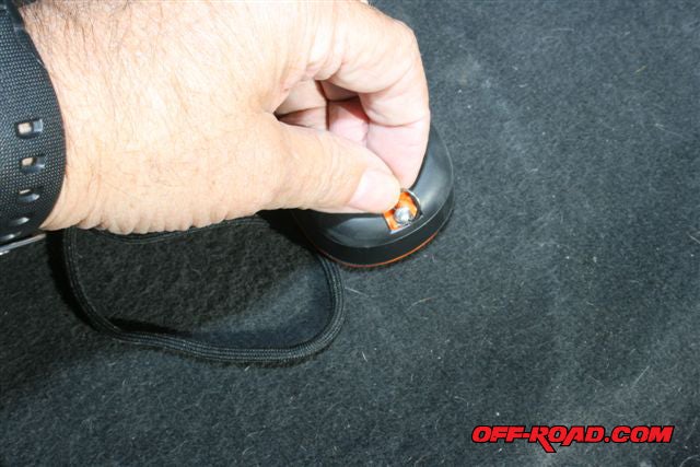
There are two ways to do this: via the included USB cable from a computer than can read the included DVDs or by using a not-included memory card reader connected to a computer’s USB port. According to the owner’s manual, the card reader is the quicker method, so that’s what I used. The PN-40’s card resides in a fold-out slot beneath the two AA batteries in the rear of the PN-40 (see accompanying photos). I didn’t time the transfer, but it didn’t take very long at all.
PAGE 3
Samsung Q1 Ultra Premium Ultra Mobile Personal Computer (UMPC)
Imagine staying in touch with everything and everyone without having to lug a heavy laptop around? The Samsung Q1 Ultra Premium UMPC can support all your PC applications no matter where you find yourself. Weighing in at less than 2 pounds (with its battery), it features an adjustable bright 7-inch touch-screen, and the latest Intel ultra-low voltage CPU.
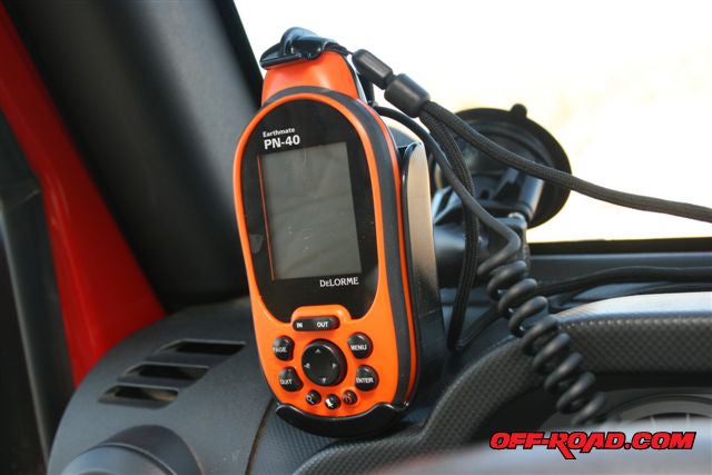 |
| The Ram mount is designed specifically for the PN-40 and holds it securely, even while bouncing around in a Jeep. I used the optional 12-VDC power cord to save the batteries for handheld operation. |
The included Windows software supports all of your PC applications just as your home and office computer do, only the UMPC does it all anytime, anywhere. This includes WiFi connectivity as standard, as well as Bluetooth 2.0, enabling you to connect to your favorite Bluetooth device. The Q1 Ultra Premium provides secure, fast connectivity at work, at home, or on the road.
The UMPC’s 7-inch-wide LCD touch-screen gives you 1024 x 600 dpi resolution and 300 nits of brightness, which add up to an incredible viewing experience whether inside or out. And its use of advanced LED backlit technology reduces overall battery consumption. When you check e-mail, you can then easily reply with the split-QWERTY keypad (although if you have large hands and fingers as I do, you might prefer to opt for the optional separate keyboard). The UMPC is also a “tablet,” which means you can use its stylus to take notes, write e-mail, boot up programs, etc. And it offers up to seven hours of continuous run time on its high-capacity Li-Ion battery so you can work and play for hours on end. Or plug it into your Jeep’s cigarette lighter.
Although there is a separated QWERTY keypad on the face of the UMPC, the buttons are very tiny and multi-functional, so I suggest the external USB-based keyboard. This comfortable-to-use and compact keyboard easily connects to your Samsung UMPC for quick and simple use. The keyboard features a pointing stick and two-button touchpad for added convenience. If you also opt for the Organizer, this portfolio is both compact and lightweight while protecting the UMPC and its keyboard. Samsung also offers an auto adapter for a quick charge on the road. As I’ve said earlier, one of my criteria for a laptop is 12VDC capability and Samsung’s Auto Power Adapter gives the UMPC that capability.
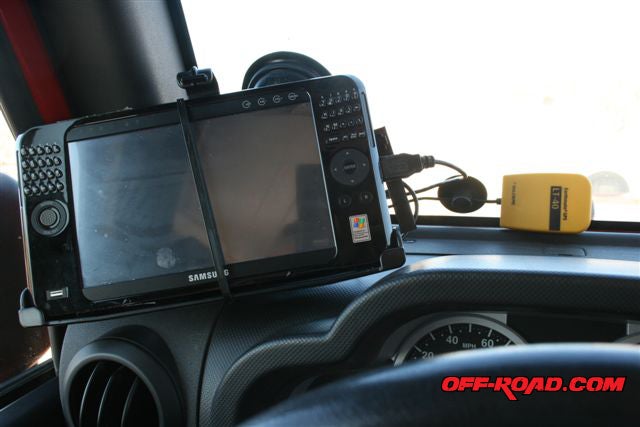 |
| Another Ram mount held the UMPC, however, this one was designed for a slightly larger UMPC. I secured it safely against Jeeping with nylon tie wraps. The lock-down suction cup remained secure on the windshield until I released the twist lock. |
A USB Data Sync Cable allows you to transfer data directly between two computers via USB. It’s a great way to move files from your UMPC to your desktop, or vice versa. And the external RW +/- Dual Layer DVD Drive will be needed for loading software and burning DVDs and CDs for photos, files, etc. This portable, external DVD drive offers USB plug and play connectivity, and it writes dual-layer DVDs for movies or large presentation output. And watch it, if you touch the wrong button, the UMPC becomes both a mirror and a camera; actually it becomes a camera with a 7-inch LCD screen that faces you, so it looks just like you’re holding a mirror. If you’re interested, I suggest you visit www.samsung.com/us/consumer/index.html and click on “personal computers.” This will also give you all the MSR prices for the various UMPC units and their accessories.
In closing, I have one more Web site for you to peruse: www.ram-mount.com. Ram Mounts offers methods for mounting the UMPC, navigation systems, laptops, cameras, and camcorders. A Ram mount can keep all the clutter to a minimum, and it secures the electronics at the same time. I used Ram mounts for both the UMPC and the PN-40 (see accompanying photos).
For those of us who grew to adulthood in the days when the only satellite circling Earth was Luna, these new GPS units and their capabilities are simply awe inspiring. Enjoy them!
 Your Privacy Choices