Mount Pinos OHV Area, California - Casa Pacifica Benefit Dual Sport
|
|||||||||||||||||||||||||||||||||||
|
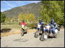
My good buddy, Dennis Towgood and I had the real pleasure of riding the Ventura County Motorcycle Club's (VCMC) Dual Sport Ride that benefits the Casa Pacifica (http://www.casapacifica.org/home.html) home for abused and mentally disturbed children. I can honestly say that this was one of the best laid out, best planned and organized rides that I have had the pleasure to participate in. Granting that the VCMC had some of the best and most scenic riding terrain to work with, and had the full cooperation of the weatherman, I still feel that they used the terrain to its best advantage. While the ride had some 30 miles of pavement that had to be negotiated, it connected some of the best single-track trails the area had to offer.
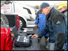
The club offered GPS tracks for the whole event, along with the customary over view maps, and roll charts for the Dual Sport traditionalists. When these tracks are loaded into a receiver like my Garmin GPS-V, and the receiver is configured for navigate mode, a display featuring an arrow overlaying a compass rosette appears, along with text boxes that tell one miles to the next turn, speed, time and elevation. This arrow points in the direction that you need to be going, and the display tells you how long before you need to make that next turn. If you should happen to blow through a turn, the arrow points in the direction you need to go to get back on course. As a backup, you can always refer to the roll chart that your riding partner has been following. What I like about the GPS is that the arrow frees you from the book keeping normally associated with the roll chart, and allows you more time to watch the trail, and to take in the scenery. Another (at least to me) welcome feature was the presence of a ranger performing a mandatory sound test before you could check in and get your roll chart. I personally feel that riders and the industry need to start taking the "Less sound, More ground" mantra much more seriously, and a few riders missing out on a ride because they violate sound rules is a small price to pay to preserve the riding areas that we have left. It astounds me how many people we run across in the forests that don't even have a spark arrester, much less an exhaust system that meets even the old 101 dB sound specification. Now if we start equipping the Highway Patrol with sound meters and go after the street riders with straight pipes, we might finally shed the outlaw image that this sport is saddled with. But let me get off the soapbox and on with the ride.
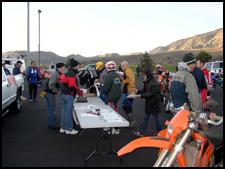
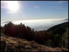
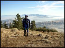
I would guess that there we as many as hundred riders that participated in this event, and at $35 to $45 a pop, that should result in a tidy little sum for the kids at Casa Pacifica. From what I could tell, most people had registered by mail, and there seemed to be few problems and little delay at the signup. Part of your registration was entry into a raffle for some donated motorcycle accessories. You received a ticket with a number on it, and the stub was placed in a raffle drum. In order to win the prize you had to check in after the ride to see if you had won a prize. To me this was a clever way of solving the age-old problem of getting riders to check in after the ride. The start took us up the frontage road towards Gorman and the Hungry Valley SVRA. Riding by the empty entry kiosk at the SVRA, we turned left and started on the Road Runner trail, which served as a good warm up run to get us ready for what was coming. Soon we found ourselves at the base of Frazier trail, which is a reasonably steep, switch-backed climb up the south face of Frazier Mountain. Some riders began to have trouble with the turns and the climb and we all began to shed the layers that we had donned against the morning cold. As we reached the rest area near the top of the trail, we were greeted with a spectacular view of the surrounding mountains just beginning break through the overcast, and a visibility that allowed us to see for probably a hundred miles.
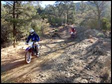
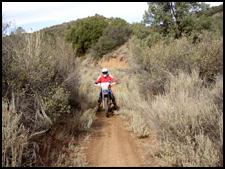
Once we reached the top, we negotiated a number of two track and single-track trails that eventually led us back down the mountain and dropped us out at Lockwood Valley Road. From here, we doubled back toward Frazier Park to enjoy some of the fine trails that are located just above and to the north of the town. Two trails were excellent, banked, single-tracks that wound up the hillside, and tied in to other two-track and jeep roads. Some residents of Frazier could literally ride out of their back yards and into the forest on some of the finest trails that I have put a knobby to. I am speaking of trails 116 going up Cold Springs Canyon and trail 114 that follows Tecuya Ridge to Cherry Creek road. Dennis and I had taken a warm-up ride on Saturday, and inadvertently found these same trails, so we could pick up our pace, as we were somewhat familiar with the terrain. What a gas to pitch the bike into a corner and ride the berm around with perfect traction and no dust - sweet!
The Forest
Service sells an excellent map of the whole area entitled Mt. Pinos
Ranger District Off-Highway Vehicle Guide that I recommend you
purchase if you plan to ride this area. This full color map has all
the trails clearly marked and rated and contains a ton of other
valuable information about the area. It covers the whole district from
I-5 to SR-33, and was the basis of the overview map provided for this
ride (see the scanned map at the end of this article.) We rejoined the road (Forest Route 95 - Mil Potrero Highway) at the bottom of Cherry Creek Road, a proceeded west towards Pine Mountain Club and our first gas stop. Pine Mountain Club is a very pretty private community complete with stores and a golf course and country club. We pulled into the Texaco station and took on about a gallon of gas, then back onto the road towards Maricopa.
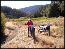
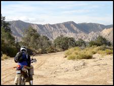
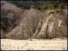
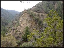
After passing Apache Saddle, we dropped off the highway onto trails 104 and 106, which take one into Quatal Canyon Wash. These trails and the one to south (105), go down long canyons that run through some very picturesque country charactering by hills with sides that have been eroded into sandstone fingers and monoliths which remind me of Bryce Canyon in Utah. These are long sand washes that require some deep-sand riding skills and a bit of speed to keep the bike from wallowing and spitting you off. With the recent rains, the sand was still damp and heavy, creating ruts that wanted to tear the handlebars from the grip of the unwary rider, but the scenery was definitely worth the work and attention demanded.
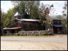
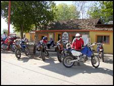
All too soon, we were on SR-33 and heading for our lunch stop "The Place" (There ain't no place anything like this place anywhere near this place, so this must be 'The Place'.) which featured Buffalo and Ostrich Burgers if your tastes run to the exotic. Dennis and I weren't particularly hungry, so we split a bag of chips and downed some soda, before striking out to our next destination, the Tinta Trail (For Advanced Riders only).
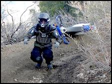
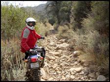
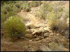
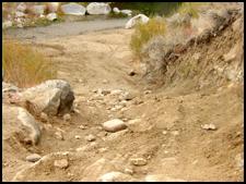
I had ridden the Gorman/Mt Pinos district for twenty years or so, but I had never been on the Tinta Trail (North on SR-33 to 9N11 (Santa Barbara Canyon Rd) which leads to West Dry Canyon Road and then to trail 101 (or 24W02) which ends on 7N04 and returns you to SR-33) that skirts the Dick Smith Wilderness. This trail is rated as Advanced Rider and you certainly will get no argument out of Dennis or I on that score. When we first started the ride, we were greeted first with a paved road, then with a well-maintained dirt road, and finally a very passable two-track trail. We knew things were starting to get serious when we came to the "gate" that restricts access to motorcycles only and soon the trail turned into a half mile boulder strew stream bed.
After negotiating the "rock garden" the trail difficulty moderated. As we proceeded up the canyon the countryside became more scenic, but the trail started to twist and turn as the canyon narrowed and the sides became steeper. As we motored up the ever-tighter trail, it was obvious that we were coming to a divide and the trail would start back down.
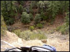
A spectacular rock outcropping accompanied by breath-taking views into the Dick Smith Wilderness that mere photos cannot do justice to mark this divide. On reaching top, the trail dropped into a steep canyon beyond in a series of steep, tight switchbacks keeping the rider on their toes.
The Tinta trail is one of the most scenic, and challenging to riders in the Los Padres National Forest, and Dennis and I figured that the rest of the ride would be sort of anticlimactic, probably a long street and dirt road ride home. While there was a fairly long paved segment down Lockwood Valley road to get back to the Frazier Park/Alamo Mountain area, the VCMC still had plenty of challenging single track in store for us. In fact, there was over thirty miles of single track awaiting us.
After about 20 miles of pavement, turned off towards Pines Springs on 7N03 and we started up the 7N15, Yellow Jacket Canyon Trail. This turned into Lockwood Trail while is heavily used by the powerful, long-suspension-travel Green Sticker machines, and showed it in the form of miles of deep whoop-de-dos. These trails certainly matched the Tinta trail for fun, if not for technical challenges and scenery.
Since it was now
approaching 3 PM and the clouds for an impending storm were beginning
to move in, Dennis and I elected to take the bail out down Lockwood
Creek Road, and jump on Lockwood Valley road for an early start on the
road home to Orange County. Braver souls than us had 20 additional
miles of trails on the North side of Frazier Mountain and the East
Side of Alamo Mountain awaiting them.
When we returned and checked it, we compared our drawing stub against the tickets that had been drawn and taped to the various prizes. I have to report that Dennis and my losing streak on drawings is intact, neither of us won a thing. However, we were real winners in riding this event and the kids of Casa Pacifica were the biggest winners of all.
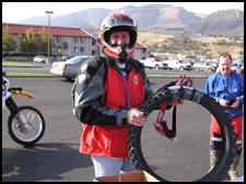
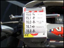
I would again like to thank and to congratulate the members of the Ventura County Motorcycle Club for putting on a first rate dual sport ride. This is especially true of the following individuals who did the course layout, John Ferro, Kriss Kudla, and Mike Koroknay and the Event coordinator Mel St. John, who is also the president of the VCMC. Thanks also to Mike Shoemaker for several of the pictures in this article. As I was walking back from verifying my bad luck at drawings, I happened to see one of the riders taking a picture of his handlebars. Being a naturally curious individual, I went over and started up a conversation to find out what he was doing. The person was George Richardson, a senior manager at American Honda Motors, and the item that he was so proud of was a very unique roll chart holder that he had cobbled together from items in his fanny pack, duct tape (what else would a bike rider use?) and inexpensive box of cough drops from the Flying J store. Apparently, he had forgotten his roll chart holder at home and no one had a spare that they could loan him. Not being one to give up and miss a ride, he found an appropriate sized box, cut a couple of slots on the top, and used his tire gauge as the spool to wind the roll chart on. He report that it worked just fine on the trail, but admitted that it would have left a lot to be desired in the rain. Right on though for his imagination and skill. McGyver would be so proud!
|
|||||||||||||||||||||||||||||||||||



 Your Privacy Choices