Magellan Explorist XL GPS
Magellans Explorist XL hits the Mark.
Getting lost just got harder!
With many new electronic devices coming into the GPS market, we decided to try out a very well known GPS equipment company.
Magellan has been around a while and forward thinking has kept them near the front of their market. As an avid woods wanderer I was looking for a hand held device that I could use anywhere, in almost any condition. This is where we get to Magellan's Explorist XL hand held GPS unit. The first thing that I noticed about the Explorist XL was the huge color screen. I'm not blind yet, but squinting to see the competition's screens wasn't fun. This screen is 3.5 inches wide and with the color zoom and backlit features I was sure this would be a great choice.
The Truefix GPS technology is designed to keep you on course. As we unboxed the Explorist XL I noticed the SD card slot. This is a great expandable feature for anyone with concerns of getting intense detail on the map they are viewing. This Magellan GPS unit comes with a 30mb hard drive for expandable mapping but to get really detailed we figured out that the SD card slot would need to be used. This is where the unit gets a little complicated.
The Magellan Map send ToPo software, which has to be purchased separately, is a moderately sized program that takes up 900mb on your PC drive. Quite honestly, it can be a bit intimidating and if you do not spend time to learn the ins and outs of the programs it never gets easier. 
We did however find that we did not need a SD card reader/writer to load the information onto the Explorist XL. The Magellan unit comes with an interface cable that attaches to the back of the Explorist XL and has a high speed USB plug on the other end. This makes information transfer a bit easier. At the time we received the Magellan GPS unit and the Map send ToPo software it had not been offered for the Mac computer so we dug out old faithful (which is what we call our Dell laptop) and loaded up the software.
When surfing through the sorted shortcuts that were installed by the Magellan software on my desktop, I found the section I had been searching for. Map send ToPo 3d USA is the place we wanted to be in order to design our custom maps for traveling up and down the East coast. After sectoring off two separate maps, because they are so big, we made a northeast and a southeast. After saving the files in Map send I loaded each of the maps on our one gig SD card. The difference in the detail of the base map and our custom maps was extrordinary.
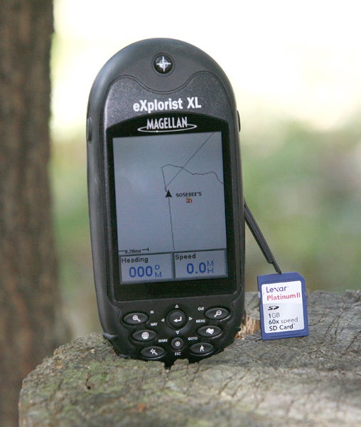
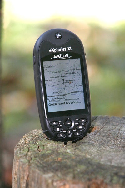
With this completed, I simply toggle between each map according to the area I am in at the time. The good thing about these expanded maps is the extreme detail and I think it even gets dirt roads, which are very important when hiking through the hills of north Georgia.
As searched deeper into the Magellan Explorist XL I noticed it would work on the water as well. So when I get in the boat I will have good directions even in the dark. The Topo software includes things like elevation and a seamless topographic map feature as well.
So now that we have our secondary map information loaded and our walking shoes on, we decided to take a short trip up through the hills near our home to see just how accurate and dependable the Explorist XL would be. As I searched through the buttons and became more familiar with the unit, it became easier to set waypoints and landmarks to keep us sure of our surroundings. Its amazing how easy the functions became once I spent a little time with it. So with almost twelve miles walked on a very warm Saturday morning I thought it was time to turn around and head back. Using just the GPS waypoints and locators I tried to not let my own memory, but that of the gps unit get us back. The Explorist only lost connection in one of the deepest valleys near our home. But once we stood out in the open our signal came right back into the GPS. Cloudy days seem to interrupt the signal in the deep woods but once locked in, the satellites are fairly hard to lose. And Magellan boasts that there are never any satellite hookup fees. 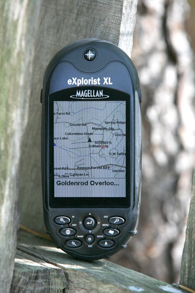
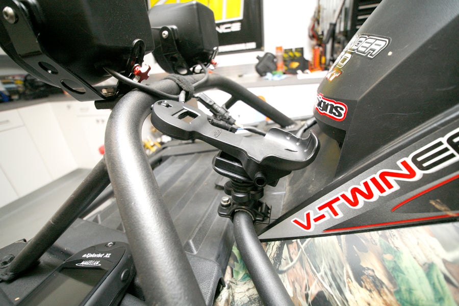
If you want to take the Explorist XL on a ride with you and your ATV, the guys at Magellan make really cool mounting brackets that will fit most applications. We mounted one up on the Workhorse just to keep us on the right track in the early pre-dawn hours of hunting season.
Overall, the best features in the handheld market are offered on the Magellan Explorist XL. In the months after receiving our Magellan unit, I also figured out that becoming dependant on a GPS is very easy to do. Once you get one you will not be able to go anywhere without it!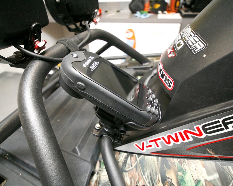
Read more about the Magellan Explorist XL and other great products at www.magellangps.com
|
Off-Road.com Newsletter Join our Weekly Newsletter to get the latest off-road news, reviews, events, and alerts! |
Follow @Off-Road
 Your Privacy Choices